
G-LiHT: Goddard's LiDAR, Hyperspectral & Thermal Imager
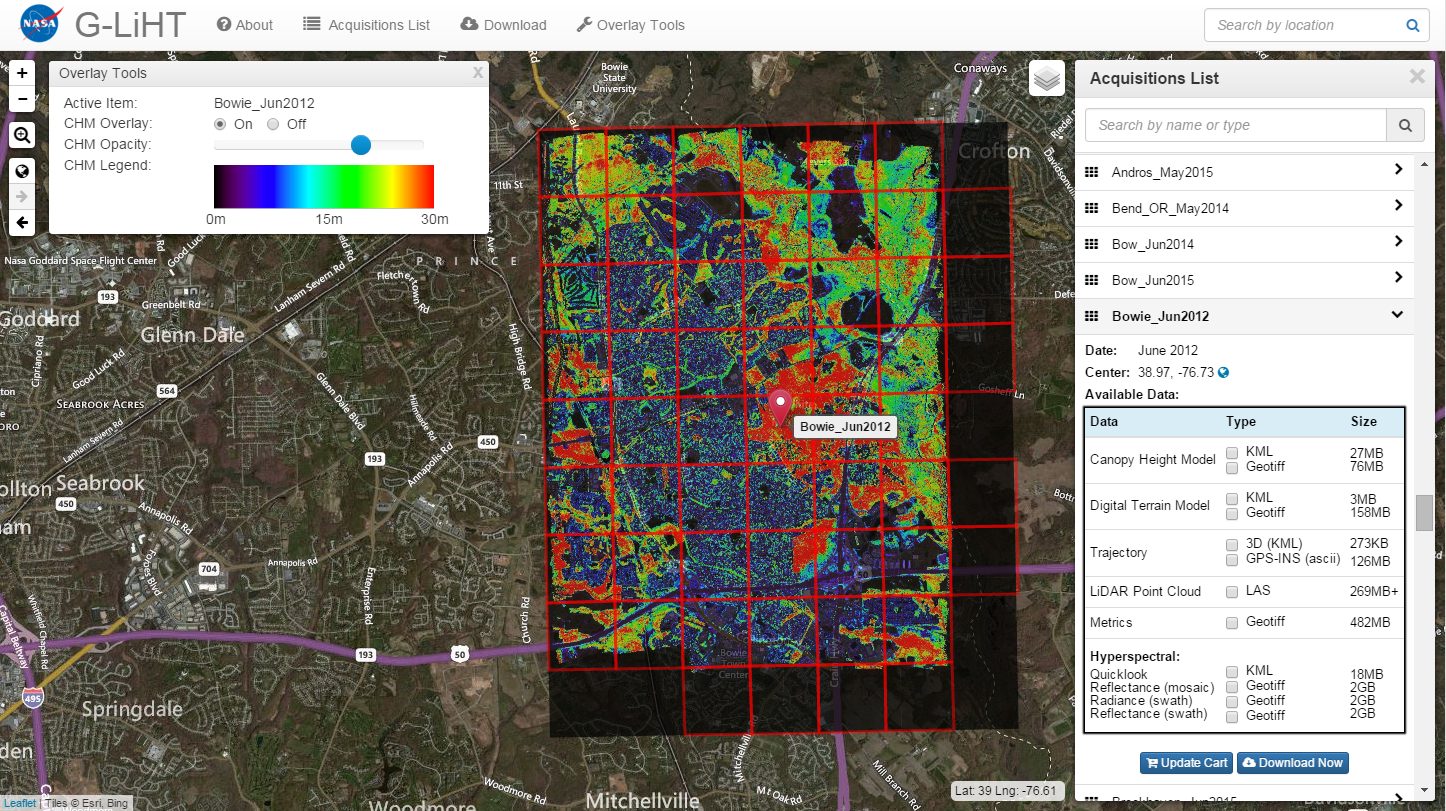
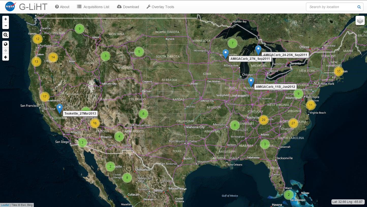
G-LiHT Data Center Webmap
G-LiHT data can be browsed and downloaded from our interactive webmap.
The webmap is under active development, and we appreciate any feedback.
What is G-LiHT?
G-LiHT is a portable, airborne imaging system that simultaneously maps the composition, structure, and function of terrestrial ecosystems using:
- LiDAR to provide 3D information about the distribution of foliage and canopy elements;
- imaging spectroscopy to discern species composition and variations in biophysical variables; and
- thermal measurements to quantify surface temperatures and detect heat and moisture stress.
G-LiHT enables data fusion studies by providing coincident data in time and space, and provides fine-scale (<1 m) observations over large areas that are needed in many ecosystem studies.
Cook, B. D., L. W. Corp, R. F. Nelson, E. M. Middleton, D. C. Morton, J. T. McCorkel, J. G. Masek, K. J. Ranson, V. Ly, and P. M. Montesano. 2013. NASA Goddard's Lidar, Hyperspectral and Thermal (G-LiHT) airborne imager. Remote Sensing 5:4045-4066, doi:10.3390/rs5084045.