
Aerial Photography
Recent G-LiHT campaigns are equipped with DSLR cameras capturing aerial photography. We are experimenting with different methods of displaying and sharing these images. The websites listed below are under active development and may be revised significantly - refer to this site for the most recent information.
We appreciate your input on these sites. Please e-mail us with your comments and concerns, or if you need any additional help using these images.
Over 100,000 photos have been taken so far. If you happen to find any especially interesting or unique ones while browsing, please let us know. We would also love to hear how you are using these images!
2017/2018 Puerto Rico Campaign
Website: https://glihtdata.gsfc.nasa.gov/puertorico/index.html
ArcGIS MapServer: https://maps.nccs.nasa.gov/image02/rest/services/gliht/201703_PuertoRico_test/MapServer
- https://maps.nccs.nasa.gov/image02/rest/services/gliht/2018_PuertoRico_footprints/MapServer
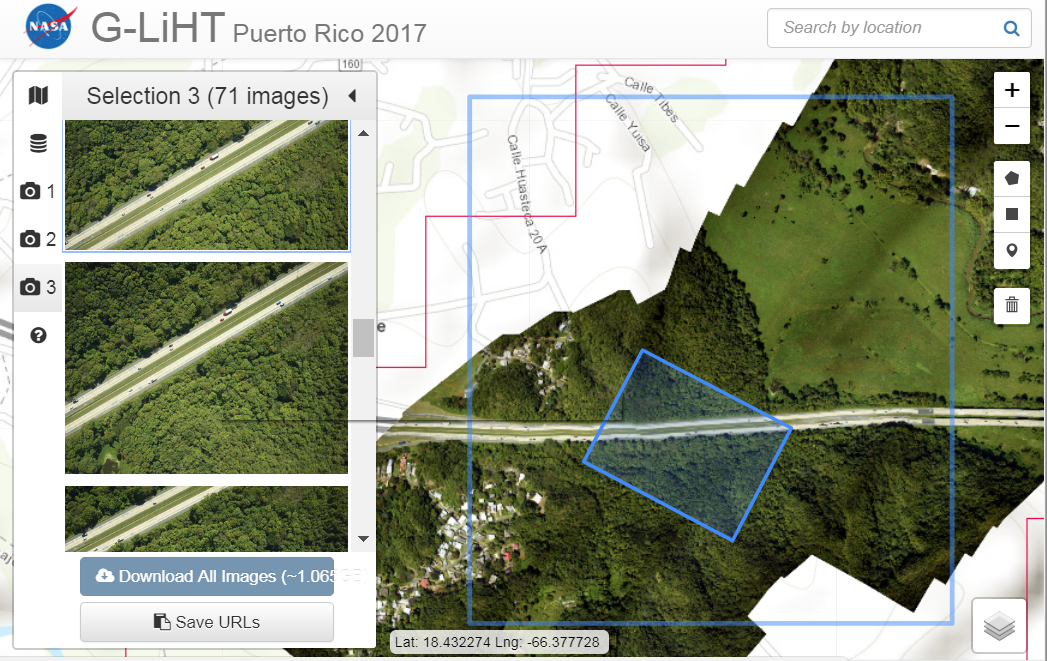
The G-LiHT (v2.0) instrument package includes a Phase One 100 MP camera (3-4 cm ground resolution). Photos were collected with 80-90% along-track overlap to support stereo analysis of canopy elements and other ground features. Raw .IIQ files were converted to compressed .jpg images, which are available for download.
The images were processed into a photomosaic using Agisoft Photoscan. The photomosaic is fairly accurate, but it is not perfect! Especially at the edges, expect some distortion. The footprint layer for each photograph was calculated using precise location data from the G-LiHT instrument and a similar method to that described below.
To view the imagery and footprint layers on the website, make sure you are zoomed in far enough and have clicked the checkbox to activate the layer. Some loading time may be required. This layer can also be loaded into your GIS of choice using the ArcGIS MapServer URL shown above.
To download individual images, use the drawing tools on the right-hand side to select an area of interest. The first 1000 images from active layers will be displayed on the left. Hover over the image in the panel to view it's location on the map, and use the up/down arrows to scroll through the image locations.
For smaller selections, you can download a package of images. For selections over 1GB, save the URLs and download via ftp. You can also download thumbnails by right-clicking the preview image and saving it, or view individual full-size images by clicking on them.
Each .jpg image has a matching .jgw file. This file can be used to load the image into a GIS. More information on world files is availlable here: https://en.wikipedia.org/wiki/World_file
2017 Florida Campaign
.png)
Website: https://glihtdata.gsfc.nasa.gov/florida/index.html
ArcGIS MapServer: https://maps.nccs.nasa.gov/image02/rest/services/gliht/photomosaic_fl_2017/MapServer
We are still in the process of publishing Florida Aerial Photography. This website features images from both before and after the 2017 hurricane season. The photomosaic layer is not yet available, but image selection can be used to pinpoint an image file at any footprint location. For more details, see the description of the Puerto Rico 2017/2018 campaign.
2014 Alaska Campaign
Website: https://glihtdata.gsfc.nasa.gov/alaska/dslr_photos.html
Data File: https://glihtdata.gsfc.nasa.gov/alaska/dslr_data_all.js
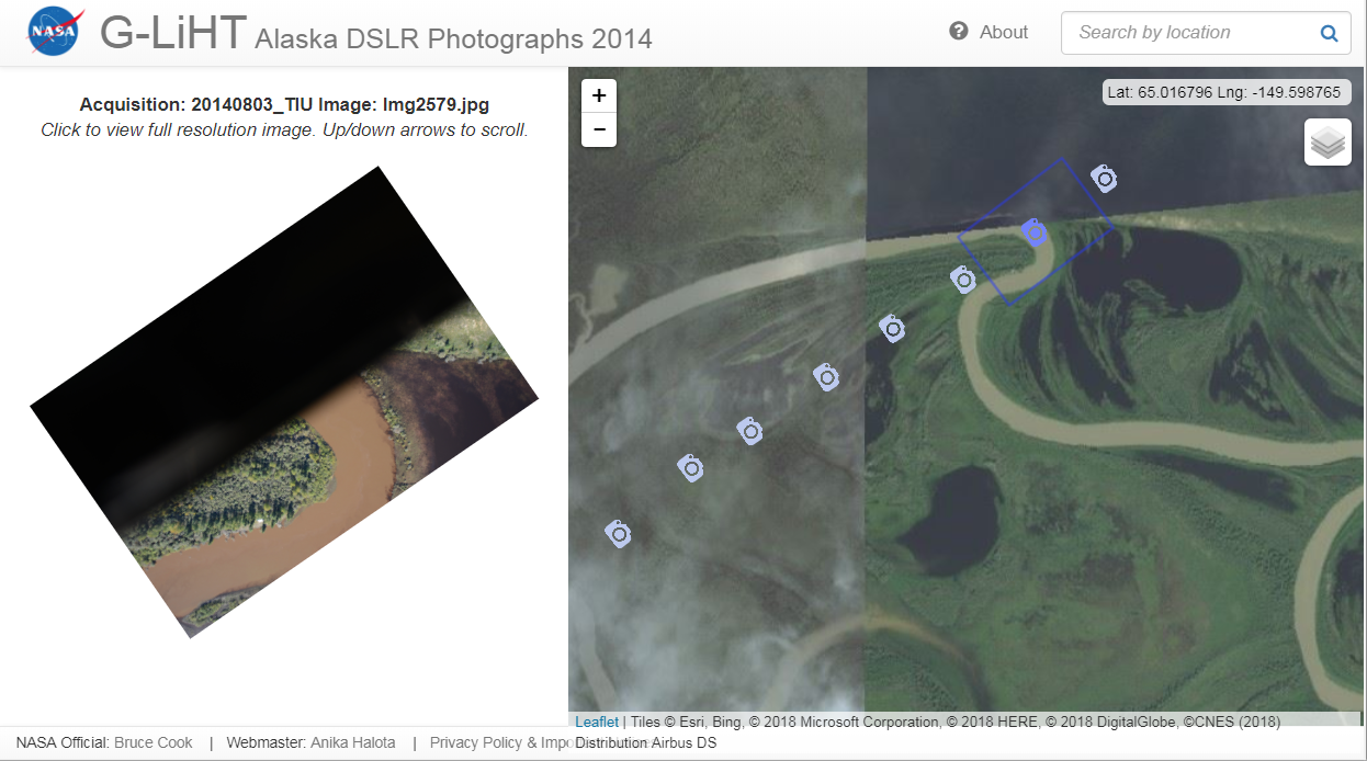
The 2014 Alaska campaign captured over 20,000 photographs, with an overlap of ~30% between images. A portion of the camera was obstructed, leaving the left half of each photograph completely black. Bounding box information is only approximate!
Zoom in on the map and hover over a camera icon to view it in the left-hand panel. Use the up/down arrows to scroll along the flight path. Click on the image on the left to download the full-size image, or right-click and save the thumbnail for a lower resolution image. The file names follow an incrementing pattern.
The downloaded images do not include any location information, but you can scan the data file to extract the estimated image center, heading(deg), and agl height. The bounding box can then be calculated following the method shown here: https://glihtdata.gsfc.nasa.gov/misc/boundingbox_calculation.txt
2018 Alaska Campaign
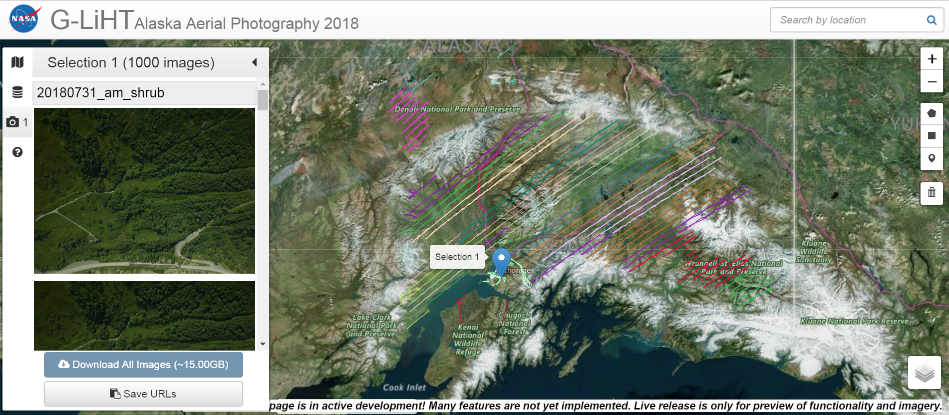
Website: https://glihtdata.gsfc.nasa.gov/alaska/index.html
ArcGIS MapServer: https://maps.nccs.nasa.gov/image02/rest/services/gliht/photomosaic_ak_2018/MapServer
We are still in the process of publishing Alaska Aerial Photography. The photomosaic layer currently only available for select flight lines, but image selection can be used to pinpoint an image file at any footprint location. For more details, see the description of the Puerto Rico 2017/2018 campaign.